Rohtang Pass
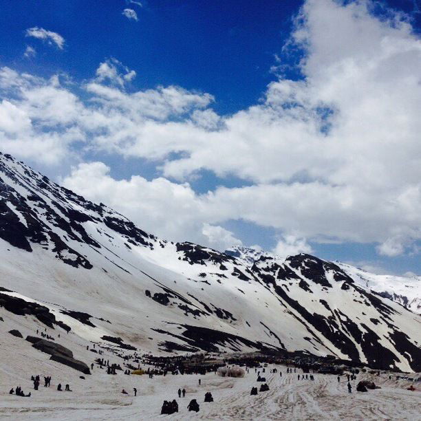
The pass provides a natural divide between the Kullu Valley with a primarily Hindu culture (in the south), and the arid high-altitude Lahaul and Spiti valleys with a Buddhistculture (in the north). The pass lies on the watershed between the Chenab and Beasbasins. On the southern side of this pass, the Beas River emerges from underground and flows southward and on its northern side, the Chandra River (flows from the eastern Himalayas), a source stream of the river Chenab, flows westward.
This pass is an ancient trade route between the people on either side of Pir Panjal. The local name for this pass is a generic name of pass. There are many other passes in Lahaul and Spiti which have specific names (Kunzam La, Baralacha La, etc.). This is suggestive of the fact that this must have been the oldest and most frequented pass in the region, or the fact that it is the main pass leading from one cultural region to another, quite different one, to the north. The name Rohtang comes from Persian/ Farsi words Ruh+ Tang which means pile of dead bodies.
The former National Highway 21 (NH 21), the road through the Kullu Valley, terminates at Manali . (The highway is now numbered NH 3.) The road northwards over the Rohtang Pass to Keylong, and Lahul and on to Leh in Ladakh is not a national highway. Nonetheless, the Leh-Manali Highway has become very busy during the summer months as an alternate military route since the Kargil Conflict in 1999. Traffic jams are common as military vehicles, trucks, and goods carriers try to navigate the tight roads and rough terrain, compounded by snow and ice at certain points and the large number of tourist vehicles.